No higher resolution available.
Dardanelles_landsat.jpg (737 × 584 pixels, file size: 593 KB, MIME type: image/jpeg)
Summary
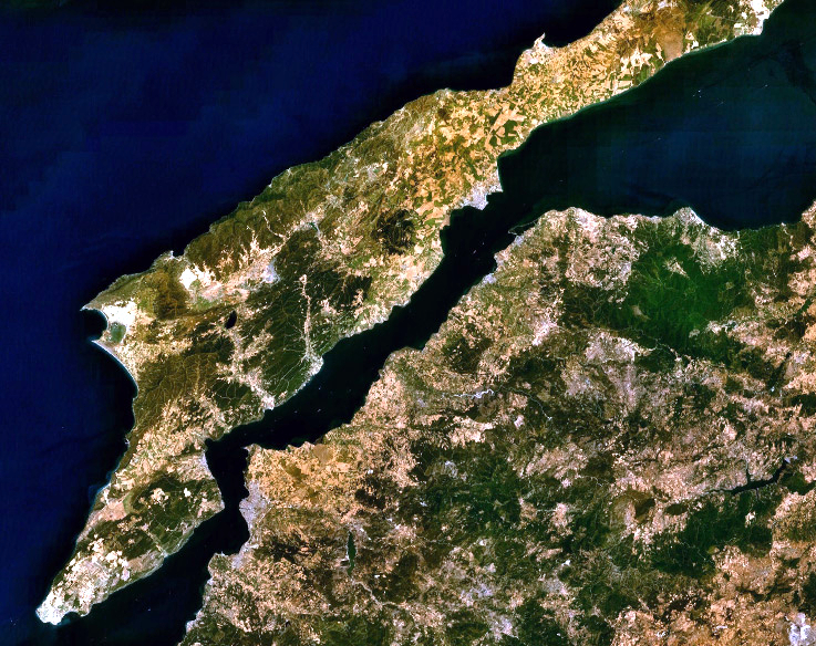
| Description |
English: Landsat 7 image of the Dardanelles and Gallipoli Peninsula, Turkey. |
|||
| Date | ||||
| Source | Captured and cropped from NASA World Wind. | |||
| Author | NASA | |||
| Permission (Reusing this file) |
|

File history
Click on a date/time to view the file as it appeared at that time.
| Date/Time | Thumbnail | Dimensions | User | Comment | |
|---|---|---|---|---|---|
| current | 04:06, 26 September 2013 | | 737 × 584 (593 KB) | wikimediacommons>Jahoe | improved colour |
File usage
The following page uses this file:
